|
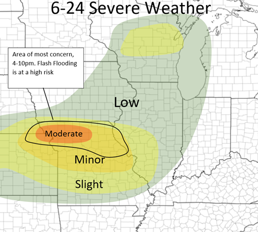
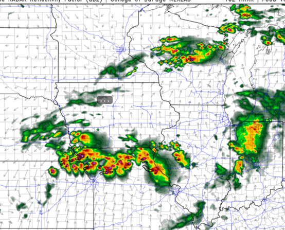
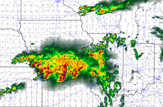
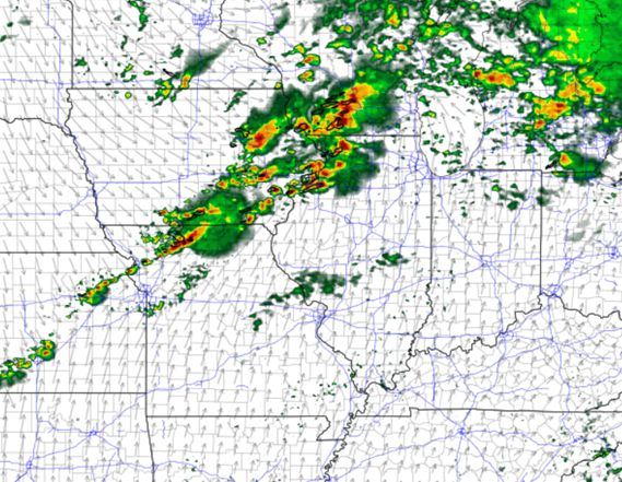
Good afternoon! This is about the heightened severe risk coming into the Mid-Mississippi River Valley today and the nest 3 days as well (briefly). Storms will fire in Northern/north-central Missouri and nearby areas mid/late afternoon. These storms will eventually form a line overnight and move central MO and the western half of IL. Supercells will develop from extreme northwest MO and form a line of cells into northeaster/east-central Missouri. All hazards will be likely including a couple tornados with these early storms. Eventually all of these storms will form a line after dark, then form bow echo(s) and move southeast/eastward into parts of IL and other parts of Missouri. Flash flooding risk is also high because the storms will train along the same areas in Missouri for hours and several inches of rain are possible this evening and overnight. The next three days also have at least a low risk of severe weather in our area, although specifics are still a little unclear. Friday and Saturday having much higher risk than Sunday's threat, but nothing too alarming yet. Stay tuned and here are some maps below! HRRR at 7pm HRRR 12am tonight
0 Comments
Good morning! In this post, I will briefly lay out tomorrow's severe threat. I will have a much more detailed post tomorrow morning.
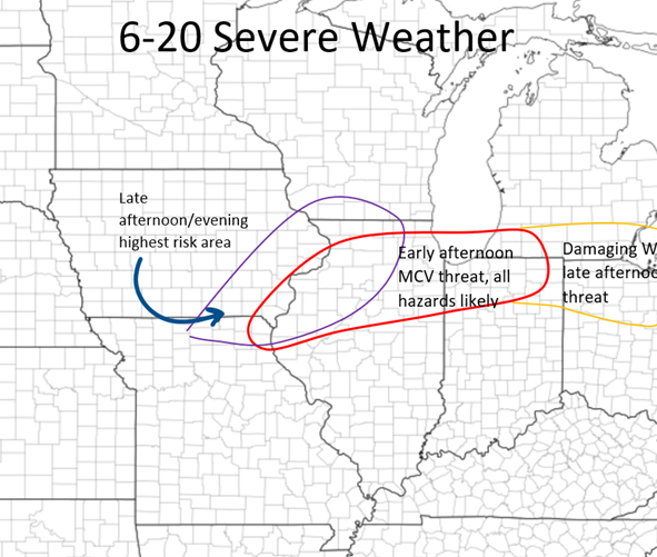
The models are all hinting at a more heightened severe weather risk tomorrow across the Midwest the models do not agree on a few specifics. Generally, there will be a MCV (Mesoscale Convective Vortex, basically just a weak low pressure that forms within a large cluster of storms) coming out of Iowa sometime during late-morning from storms in the central Plains overnight. The placement of these and the values of certain ingredients are a bit unclear, but it is safe to say that this will cause some severe weather, if not some significant severe weather in the Northern half/third of IL early afternoon tomorrow. The NAM has it shooting across the I90 corridor whereas the HRRR has it shooting across just north of the Highway US 24 corridor and north. All threats will be possible with this cluster of storms. This will continue to move east and form more of a damaging wind threat the more east it travels into IN/MI and into OH by late afternoon. A second area will develop in the afternoon along the Mississippi River and west. For now, these will pose a large hail threat primarily, then more of a damaging wind threat over NE and central IL after dark, but some specifics are unclear with the movement of the MCV before this which could inhabit and cap the environment behind it for a longer period of time if it moves at a slower pace. We will see! Below I have a outlook map, a possibilities map. Stay tuned! Good morning guys, who's ready for another full day (two days coming actually) of severe weather! I am!
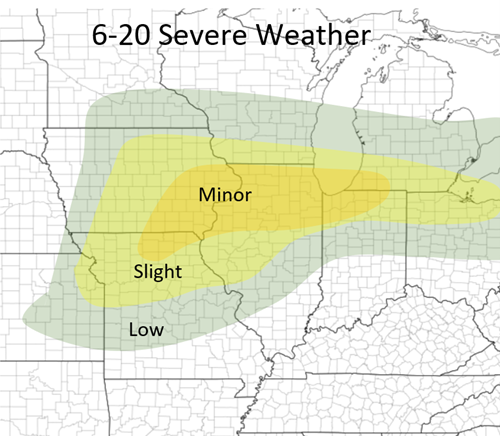
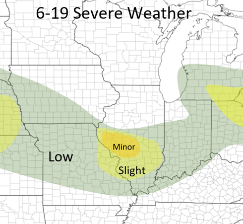
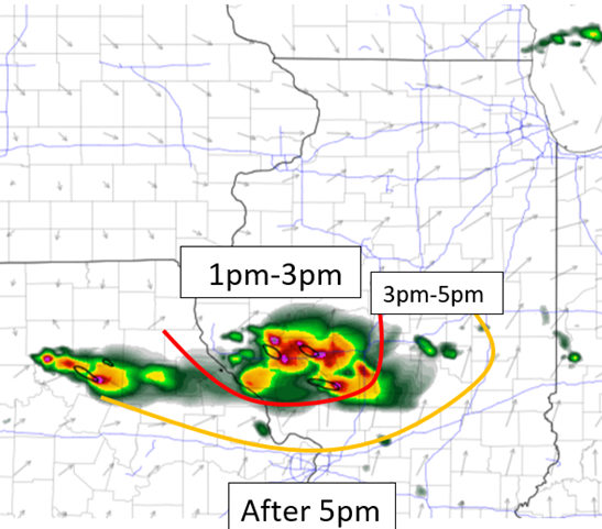
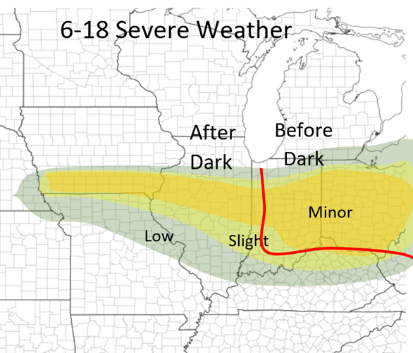
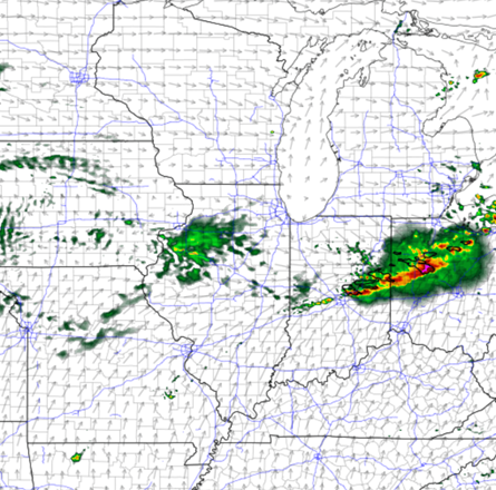
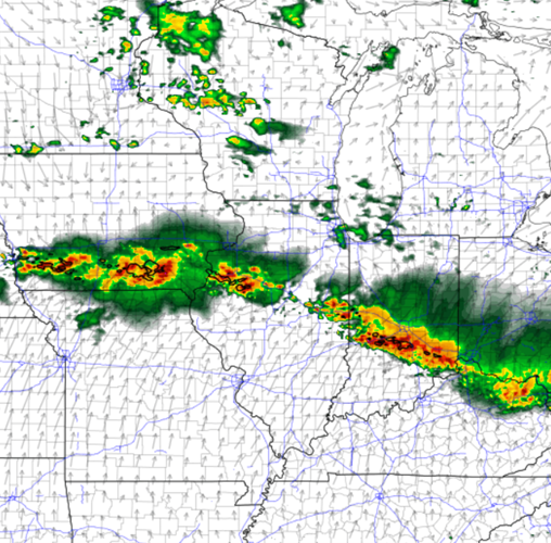
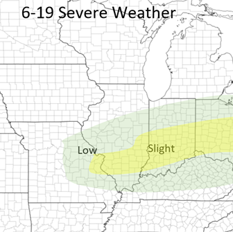
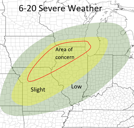
TODAY: There will be a small area of heightened risk over central and south-central IL this afternoon. Hail and Damaging Wind threat (especially hail is the main concern) from along I72 and south. There is an isolated tornado threat with some small wind shear, but not a strong threat. These storms will form along and near I72 from Springfield to Pittsfield between 1-2:30, organize, and continue southeast. The environment is very favorable for strong updrafts with CAPE values in the 2,500-3,500+ range within a range of Springfield and west. I would assume they form along a small boundary that was set out from this morning's storms. So here is my outlook for today as well as a timing map for this small line of storms! Stay tuned! Good afternoon guys! It has been awhile since a good severe weather day in Illinois! Well, the next three days are all going to be worth watching, especially today (Friday) and Sunday! I will mostly discuss today's threat and briefly touch on tomorrow's and Sunday's. I will go more details on those on the day of! So, even just 6-12 hours before this severe weather setup on folds, the HRRR and the NAM are disagreeing with each other like they always do and this is making things complicated. Both agree that there will be severe storms, and for IL both do agree that there will be some severe storms that will fire after dark in central IL. But, the main action this afternoon across Indiana and Ohio is what is being questioned. The NAM has boldly stuck with this line forming around 3/4 in NE Indiana and NW Ohio and charging south to southeast, this being mostly a damaging wind threat but Hail and a couple Tornadoes are possible as well. The HRRR is is showing little development until very late, near sunset further south with not as significant as a threat. Although the HRRR was more correct with yesterday's storms, I will guess the NAM to be more in the right today as with what I am seeing with the ingredients as well as there are already a couple storms forming just north of me here in East-central IL which means that the atmosphere is already primed up. TIMING: Eastern Indiana (into central) and much of the western half of Ohio, be on guard from 3-7 this afternoon as that line segment heads south. If the HRRR will be correct, then there will be little development until 6/7pm tonight. FOR ILLINOIS: most storms will not initiate until near or after dark due to the front stalling across southern Iowa and Northern IL, with very high instability (3,000-4,000+) among other factors, but develop late due to an enhancement of South to Southwest winds in Iowa which will interact more with the front and cause storms to fire after dark (9/10ish for the first storms). Due to high instability and high lapse rates, HAIL will be the greatest outmost concern with these (along with damaging wind), which could produce large to very large hail within a small corridor from Southern Iowa and Central IL. These storms will mostly start off in Iowa but expect by midnight a line of storms from Southern Iowa to West-central Indiana, most storms within this line being strong to severe. This threat will terminate by 3/4am hopefully. A tornado or two is also not completely ruled out but wind shear will not be as strong as it is across the IN/OH region this afternoon. So today should be watched and also look at the radar before you plan and going anywhere in each region and the specified times above. NAM at 5pm NAM at 12am Below I have my thoughts on the outlooks from Saturday and Sunday. I will have many more details in the next two days! These are subject to change. Stay tuned! NAM 7pm Sunday
|
Details
AuthorWrite something about yourself. No need to be fancy, just an overview. Archives
January 2024
Categories |
 RSS Feed