|
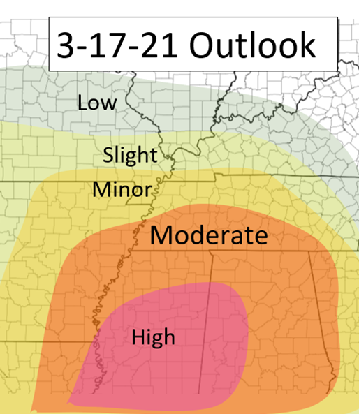
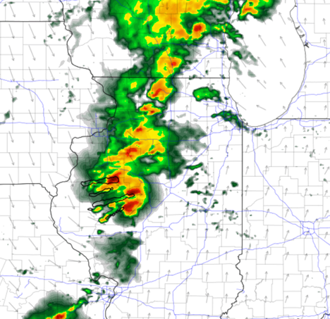
Good morning everyone! Today's severe weather risk is heightened and all should be on guard in these areas. Many tornadoes will be possible and violent long tracked tornadoes are possible as well. Stay alert! Although there are still some slight differences between the models, the models both agree on a big severe event taking place. Here are the specifics: There is a large area that will be under a Moderate to High risk for severe storms today, as well as A FEW rounds of storms, not just one! AR/MO/TN/KT: This region will see a few rounds storms during the day. the first round will be lifting along the warm from reaching the Memphis area by around the 8am timeframe. These will mostly be sub severe although a couple could be severe. This batch will slowly continue northeastward along the warm front. This is where the models start to diverge, but not by much. The HRRR shows a new line of convection coming into the eastern Arkansas region by late 10am. By this time, CAPE values just south of this will be 1,000-1,500, and with enough wind shear, this line could turn severe as it pushes east and continues to strengthen. The HRRR continues to push this to the east into Western Tennessee by noon and really strengthens this line, and continues to stay on the edge of the warm front, tapping into more favorable environments just to the south. This line will dissipate likely by the mid afternoon in central TN but this is the first main round of concern for this region. Below I have a picture of the 1AM HRRR at 11am showing this region. There will be enough clearing behind this system for storms to fire along the advancing Cold front, and possibly again along the warm front in place from extreme southern MO and through northern and central Tennessee. The line of storms triggered by the cold front will reach Eastern Arkansas by 4-6pm likely. Depending how much destabilization will occur since the passing of the early afternoon storms, will determine how strong these storms can get. Nonetheless, these will be strong but the severe threat including multiple tornadoes will be dependent on this. This line will continue to push East Northeast across the MS River and will continue into Tennessee in the early overnight hours.
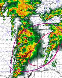
LA/MS/AL Although the threat is quite high in the other region, this area is the greatest concern for the worst threats from this event. In the early afternoon, cells will likely develop in the warm sector in eastern MS and AL (in the pink circled area in the map below. This will be round 1 and these could bring hail as well as tornadoes. These will start to develop around 1pm. The next main threat is the line that I had already mentioned for the area above. There is a bit more of a heightened risk with this line more south starting in NE LA and into central MS. The line will cross over the MS river at around Duck and will continue into MS and then into AL during the late evening and overnight hours. This line will have every severe threat including the threat of a few tornadoes and some that could be dangerous and long-tracked (triggering the High Risk). Be very careful during the early overnight hours in this region. THE MAP BELOW shows (in pink) where the threat of the afternoon supercells and then (in the purple) where the highest nighttime threat is with that advancing line of storms. All for now, stay safe everyone!
0 Comments
|
Details
AuthorWrite something about yourself. No need to be fancy, just an overview. Archives
January 2024
Categories |


 RSS Feed