|
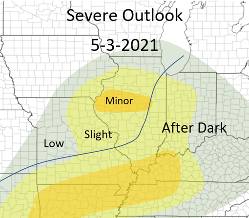
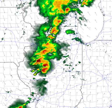
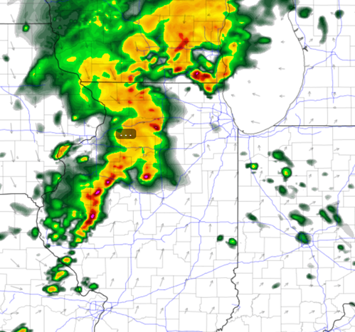
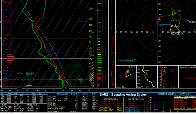
Good morning! FINALLY! An active day of severe weather in Central Illinois! It has been way too long! I am excited to get out and watch and study the storms today! TIMING: 2-6pm (west of IL River) 5:30-9:3pm (east of IL River) HAZARDS: ALL severe weather components today (even a couple/few tornadoes are possible) I am going a little bold within our region today. Below in my outlook, I have put a more specialized risk area for the small region in Central IL that will be at highest risk. I was going back and forth between just keeping it with Slight or bumping it up but based off the latest 12z NAM and HRRR models, I have a MINOR risk area for some part of Central IL today! The Storms will be developing along and south of a MCV (Mesoscale Convective Vortex) from the storms overnight from the Great Plains, which will be coming out of IA/MO mid-afternoon. with CAPE values in the 1000-1500+ range, dewpoints in the lower to mid 60s, a strengthening low level jet (late), and a small area of strong upper level winds (from 4pm and on, this virtually develops out of nowhere), this is a PRIME environment for some severe weather today. This event is actually very similar to the July 15 2020 event in that we have a MCV coming out of the same area and will have a line of storms develop along and just south of it with nearly the same conditions. On that day there were a few tornadoes in our region including one wide one I photographed! So these storms will ignite along and the the Mississippi River in the 3-5pm timeframe, and will race east in Central IL. I WOULD NOT be surprised if a couple renegade cells form in front of this line (2-5pm) and could pose a hail/tornado threat as well, as the HRRR is hinting on this possibly occurring. This will finally cool off in Eastern IL and Western IN by 8-10pm tonight The other area is down in the Ozarks and the Ohio River/Mississippi River region. These storms will form after dark in the Ozarks to Eastern Oklahoma and will race Northeast/East. Some may form in the Ohio/MS River region early overnight as well. All threats with this will be possible but damaging winds are the main component with these! That is all for now! Stay tuned for tomorrow's Severe weather as well, if anything changes today I will update! Today's Outlook NAM at 7pm HRRR at 6pm NAM weather sounding at 6pm showing ample CAPE (the area between the blue dotted line and the red line), Dew Point, and Wind Shear!
0 Comments
|
Details
AuthorWrite something about yourself. No need to be fancy, just an overview. Archives
January 2024
Categories |


 RSS Feed