|
Good afternoon! This is about the heightened severe risk coming into the Mid-Mississippi River Valley today and the nest 3 days as well (briefly). Storms will fire in Northern/north-central Missouri and nearby areas mid/late afternoon. These storms will eventually form a line overnight and move central MO and the western half of IL. Supercells will develop from extreme northwest MO and form a line of cells into northeaster/east-central Missouri. All hazards will be likely including a couple tornados with these early storms. Eventually all of these storms will form a line after dark, then form bow echo(s) and move southeast/eastward into parts of IL and other parts of Missouri. Flash flooding risk is also high because the storms will train along the same areas in Missouri for hours and several inches of rain are possible this evening and overnight. The next three days also have at least a low risk of severe weather in our area, although specifics are still a little unclear. Friday and Saturday having much higher risk than Sunday's threat, but nothing too alarming yet. Stay tuned and here are some maps below! 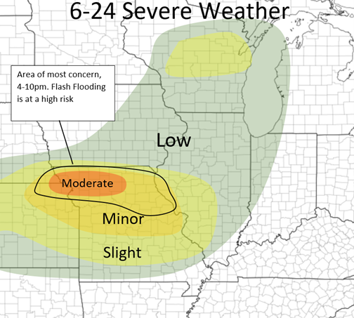 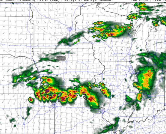 HRRR at 7pm 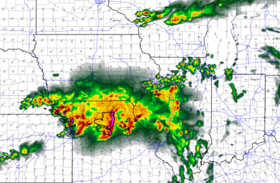 HRRR 12am tonight
0 Comments
Leave a Reply. |
AuthorWrite something about yourself. No need to be fancy, just an overview. Archives
January 2024
Categories |
 RSS Feed