|
Good morning guys, who's ready for another full day (two days coming actually) of severe weather! I am! TODAY: There will be a small area of heightened risk over central and south-central IL this afternoon. Hail and Damaging Wind threat (especially hail is the main concern) from along I72 and south. There is an isolated tornado threat with some small wind shear, but not a strong threat. These storms will form along and near I72 from Springfield to Pittsfield between 1-2:30, organize, and continue southeast. The environment is very favorable for strong updrafts with CAPE values in the 2,500-3,500+ range within a range of Springfield and west. I would assume they form along a small boundary that was set out from this morning's storms. So here is my outlook for today as well as a timing map for this small line of storms! Stay tuned! 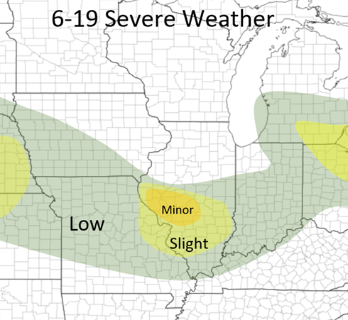 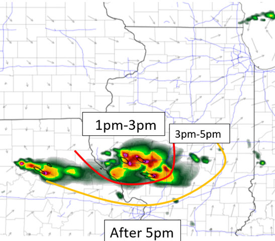
0 Comments
Leave a Reply. |
AuthorWrite something about yourself. No need to be fancy, just an overview. Archives
January 2024
Categories |
 RSS Feed