|
Good evening guys! In this post I will mostly talk about the system that will be tracking into the mid-Mississippi River Valley early next week but I will briefly touch on the weakening system coming into our region tonight (Saturday night). Also, I will have 1-2 updates Sunday (for sure Sunday evening) over Monday's system on here as well. Generally 0-1 inches of snow from I72 and north in IL, and generally .5-2 north of I80 in northern IL. Also a glaze of ice is possible in Central IL but nothing more than that. Most of this will come late Saturday Night and Sunday Morning. The much bigger event comes Monday Morning into our region. There's a Low pressure system that will make it's way out of the Ark/La/Tx region Monday morning and shot up to the northeast into the Ozarks region by Monday afternoon. This system starts to lose it's strength into Tuesday over the Eastern Midwest, I would assume due to the occlusion or the weakening of the upper level trough but I hadn't looked into that much yet. Precip should start in central IL Monday morning and Snow should start in Northern IL (for now) around or just after noon on Monday, with the heaviest snow Monday evening. I will have start times in a later post when this event becomes a little more clear. First, here's a general "what to expect" of this system map I made: 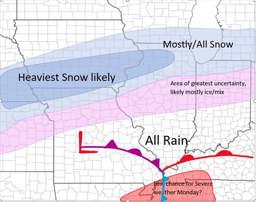 There is that area of uncertainty where it will likely be a mix/ice in central IL but could/will change mostly to rain by the peak of the system as it moves across our area Monday evening. Some models like the NAM pick up with more Freezing Rain event for that region and the HRRR has a much slimmer area of mix/Ice and has more Rain for that middle region. Below I have a "guess" for the Snowfall totals but this is going to change in the next 24 hours I am sure: 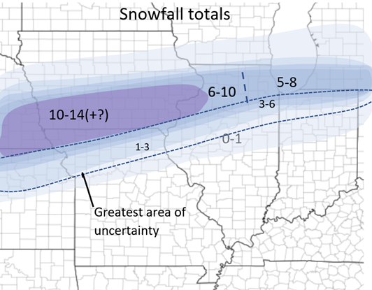 Next I have a general map with areas that may see ice during this event. Nothing clear yet since the models are not agreeing with each other yet but we will see what changes in the next 24 hours! 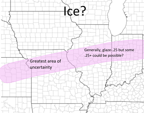 Now I will show some of the models and what they are showing. The model and the type will be below each picture: 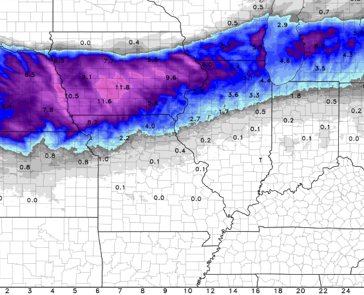 NAM snowfall totals 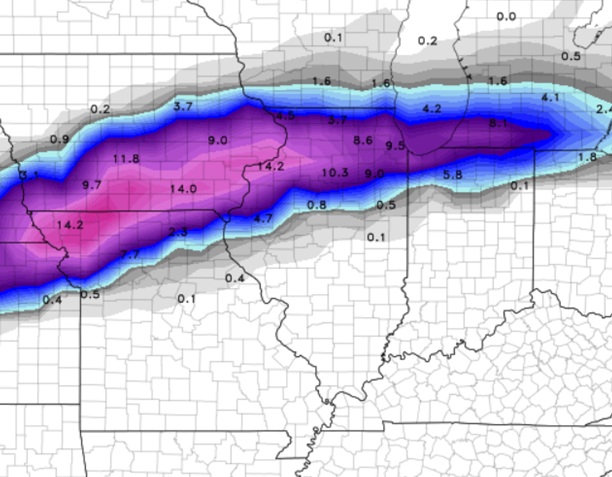 GFS snowfall totals 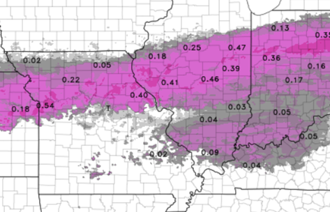 NAM Freezing Rain (Ice) Totals 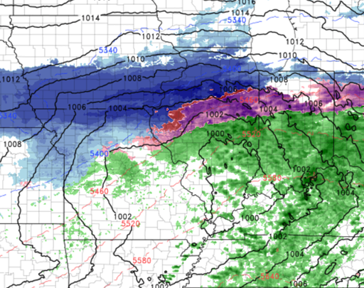 NAM model at 4pm on Monday That is all for now. As always message me or leave a comment if you guys have any questions! Much more to come tomorrow when the models agree more with one another and there's multiple I can look through as well. Also a weak system will be coming through mid-week that may dump a couple inches in southern IL that I will continue to watch! Stay tuned!
0 Comments
Leave a Reply. |
AuthorWrite something about yourself. No need to be fancy, just an overview. Archives
January 2024
Categories |
 RSS Feed