|
Good morning everyone! Today's risk the main focus will be across a large portion of Wisconsin, as well as Northeastern Iowa and Western Upper Peninsula of Michigan. All threats will be likely including a few tornadoes, some could be quite strong. The main timing of this event will be 2-8pm, although more of a damaging wind threat after 8 across portions of Eastern Wisconsin, Northern Illinois, and other parts of the Upper Peninsula of Michigan. Below I have my outlook and timing for the event today: 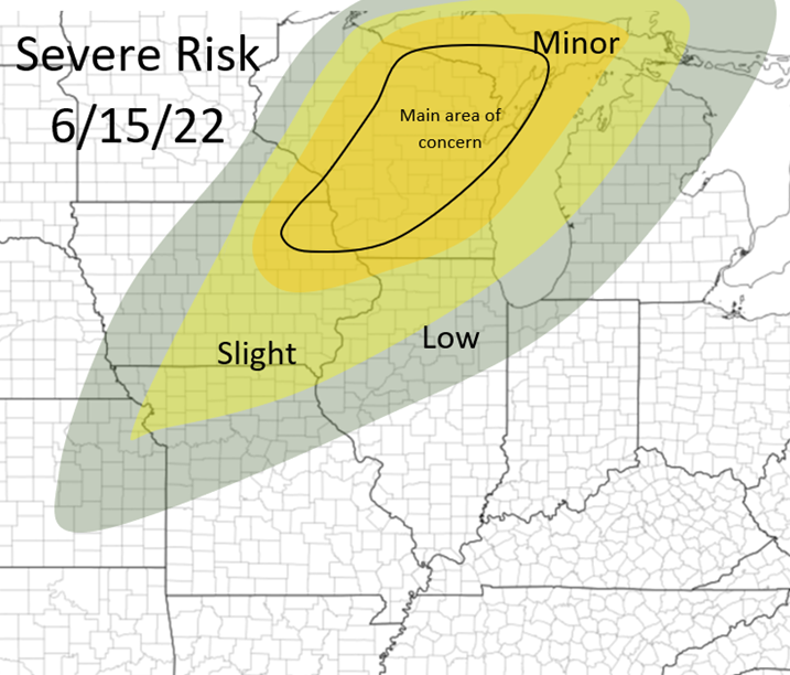 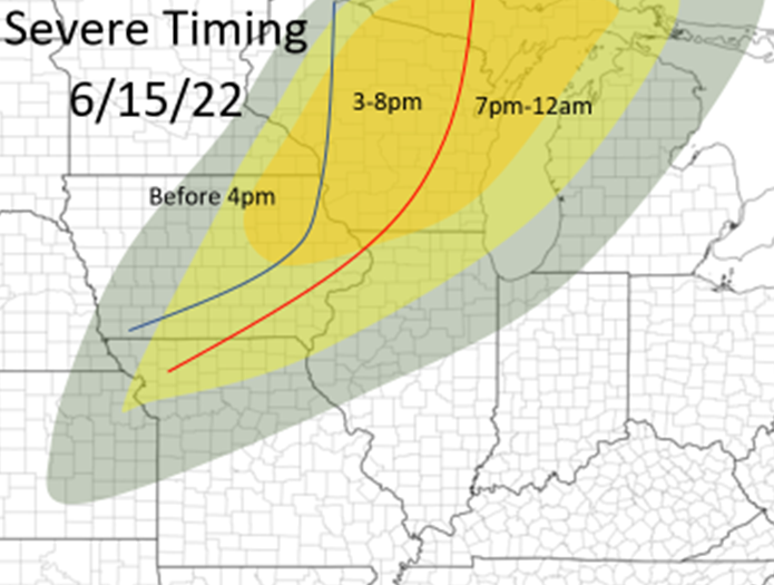 The storms will fire between 1-4pm over portions of Northeastern Iowa, far Southeastern Minnesota, and Western Wisconsin, and track northeast. The main tornado risk is earlier this evening, across portions of Iowa, Western and Northern half of Wisconsin (areas within the minor risk), and the Western Upper Peninsula of Michigan. CAPE values will be 2500+ across most of this area, the best shear will be across areas in Northern Wisconsin with a more southerly to southeasterly surface flow, although in areas with greater CAPE across all areas of southern Wisconsin (seen in picture below). There is also a slight concern about this morning convection coming out of Iowa by inhibit the extent or intensity of CAPE to Northern Wisconsin this afternoon. Early on in the afternoon should have enough shear to also pose a strong tornado threat as well in Southern Wisconsin, before winds become more southwesterly producing less ample wind shear for tornadic storms. After these storms move into Eastern Wisconsin this afternoon and nearby areas, the storms will become more linear in mode and pose a more damaging wind threat, although all threats can not be ruled out. All for now! Stay tuned for more! 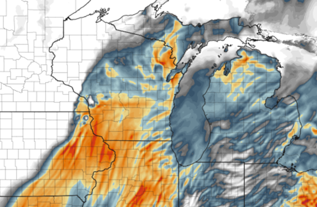 HRRR CAPE map from the afternoon, showing higher CAPE values in Southern Wisconsin but stronger wind shear will likely be across areas of Northern Wisconsin, but strong shear will be all throughout the threat area today 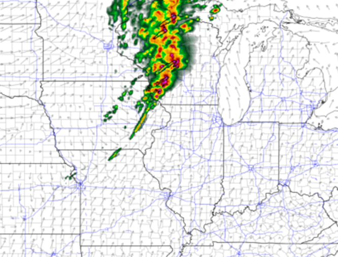 HRRR at 5pm, showing a line of storms erupting across Western and Central Wisconsin
0 Comments
Leave a Reply. |
AuthorWrite something about yourself. No need to be fancy, just an overview. Archives
January 2024
Categories |
 RSS Feed