|
5:00am update:
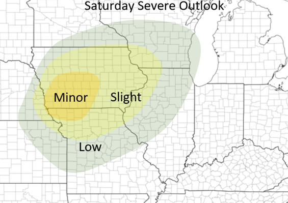
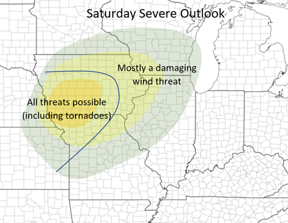
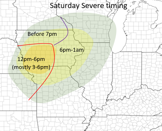
Good morning everyone! I hope everyone enjoys this beautiful, but windy day throughout Central Illinois! For my Iowa and nearby friends, it is looking like strong to severe storms will be possible throughout the state during the afternoon and into the evening! Worst timing: 3-7pm Threats: Damaging Winds, Hail, and a few tornadoes Main area of concern: Southwest into Central Iowa The deepening surface low is expected to slowly move across the Missouri River during the mid-afternoon hours into Iowa, bringing within the chance of severe weather ahead of it throughout parts of Iowa, Northern Missouri, and areas beyond. There appears to be some storms possibly as early as noon along and near I80 along and near the advancing warm front but the main focus will be from 3-7 pm between Des Moines Iowa and Omaha Nebraska. A very narrow corridor of barely sufficient CAPE (instability) will set up just in front of the advancing dryline correlated with the system (x>1,000). The lower to mid-level winds will strengthen during the afternoon creating a stronger speed and directional shear with mid-level winds becoming more southwesterly by late afternoon. Dewpoints are also expected to reach at least the upper 50s, if not barely peak above 60 just ahead of the dry line. With all of these, this makes this event possible over this region. There are still some discrepancies between the HRRR/RAP and the NAM, with the NAM showing a slightly less ample atmosphere ahead of the system but either way, severe weather will be possible in this region The maps for my forecast outlook, threats, and timings are below. Hint at the more heightened area I highlighted in southwestern and central Iowa. At the CURRENT time this is what appears to be the area at highest risk! Stay tuned! I will post updates if needed!
0 Comments
Leave a Reply. |
Details
AuthorWrite something about yourself. No need to be fancy, just an overview. Archives
January 2024
Categories |


 RSS Feed