|
This is the first update for the major system developing in the southern plains and rocketing across the Ohio River Valley mid to late this week! Major, possibly significant winter weather along with severe weather and flooding are all likely with this event! WINTER WEATHER: Generally, this event will start out as rain throughout the region during Wednesday afternoon and evening. Throughout the early morning and daylight morning hours Thursday north of I70, especially north of I72 earlier one, will change to wintry precipitation. Most of the precipitation will tapper out throughout Thursday evening and early night hours from west to east throughout the state. Higher snow, sleet, and ice amounts could be possible, but exact amounts are unclear due to the event still being 36 hours out. It is also important to note the very strong winds associated with this system that could cause lots of problems as well! The models are starting to agree more with one another. The HRRR is still showing a slightly more southern track due to a slightly more south trough projection Wednesday Night in the Southern Plains while the system is forming, leading to a slightly more southern track comparing to the NAM. Below I have some very general forecasts of what could happen. More specific updates will come Wednesday Evening and throughout the day Thursday! 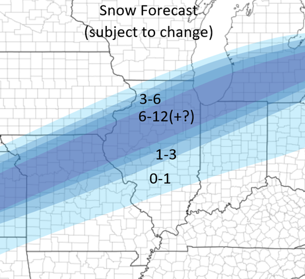 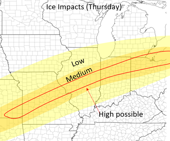 SEVERE WEATHER: Severe weather is possible during Wednesday Night in the Southern Plains and on Thursday over the lower Ohio and Mississippi River Valleys. Wednesday Night the storms will fire around and after Midnight over areas near the Red River Valley in Oklahoma and Texas. These storms will continue northeastward during the nighttime hours. Thursday is potentially more significant although some details still remain unclear. The system starts to veer out so winds because slightly more southwesterly in the lower levels, but the major concern is the lack of instability in place. Despite ample dew points, the lack of instability limits storm growth and how strong storms can get on Thursday. Nonetheless, some strong to severe storms will be likely in these regions. See the outlook maps I created below (also poste in the outlooks tab). Stay tuned and more updates to come soon! 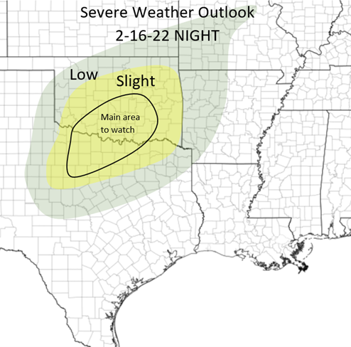 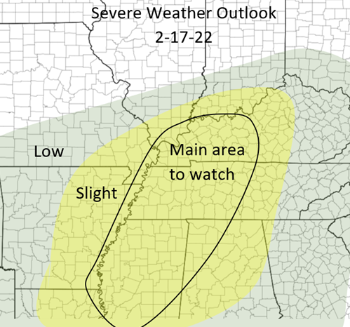
0 Comments
Leave a Reply. |
AuthorWrite something about yourself. No need to be fancy, just an overview. Archives
January 2024
Categories |
 RSS Feed