|
Good afternoon! I hope everyone has had a great start to the year! Unlike usual, I will start out with my official (current) forecast of this upcoming event and what to (generally) expect throughout, then a short explanation of the event. There will be a fairly sharp gradient in S IL between 6+ totals and close to nothing. A shift in 25 miles can mean the difference of very different totals downstate. Specific forecasts for a few locations are below the forecast as well: 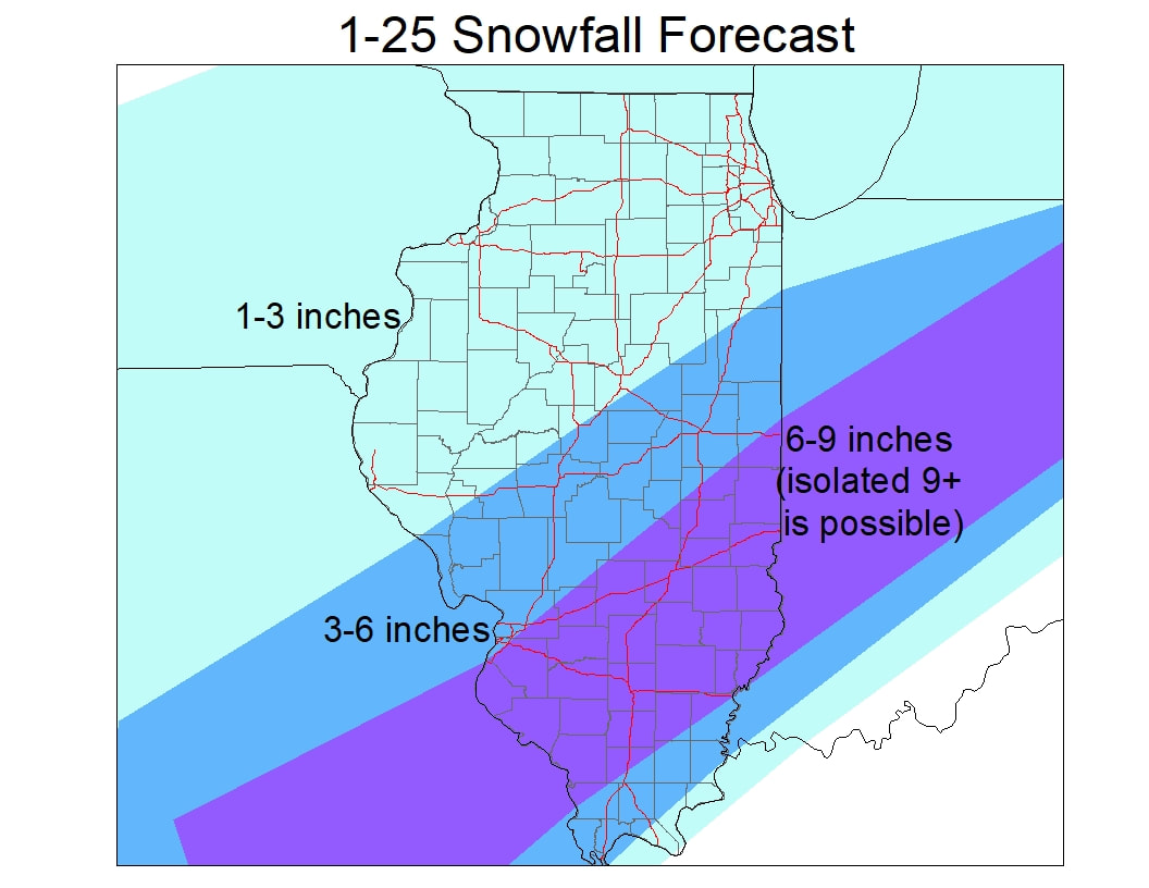 Central IL: Jacksonville: 2-4 Peoria: 1-3 Bloomington: 2-4 Springfield: 2-4 Decatur: 3-5 Champaign: 4-6 Danville: 5-8 Kankakee: 2-4 Southern IL: Effingham: 6-9 Olney: 6-9 Carlyle: 6-9 East St. Louis: 3-5 Carbondale: 5-8 Northern IL: 1-2 throughout with some isolated 2-3 inch totals 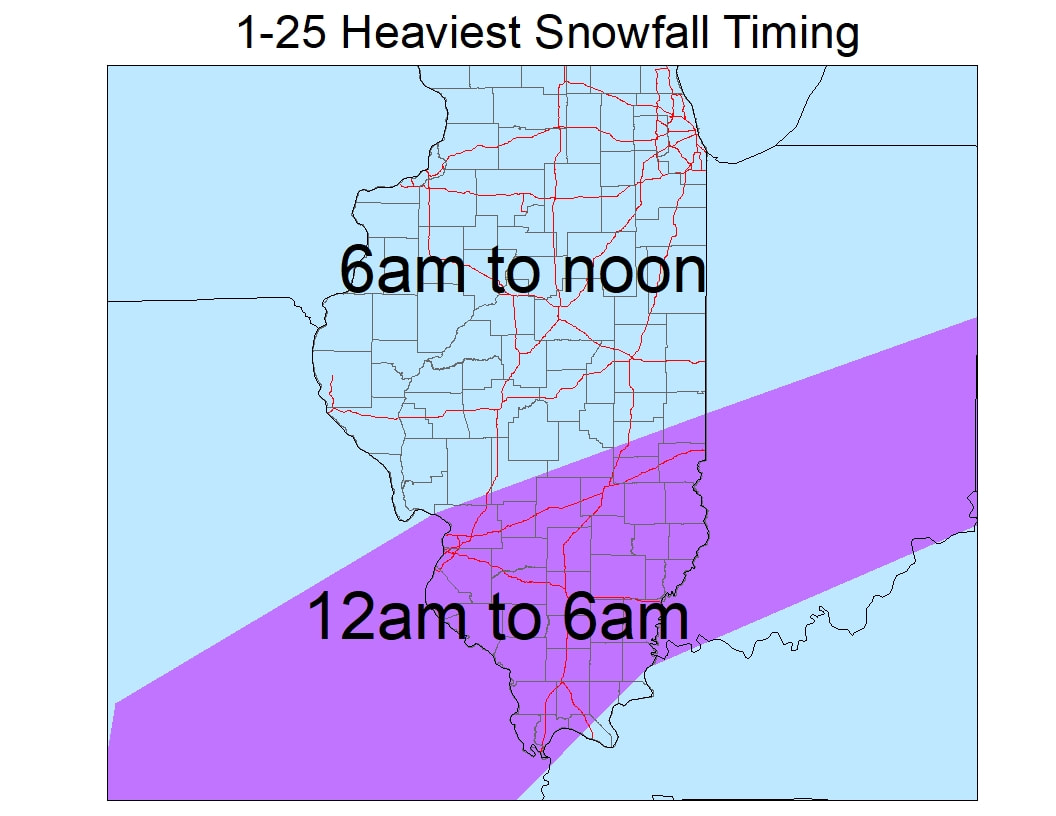 General synopsis:
This event will start as primarily rain before midnight in most areas south of I72. Temperatures start out in the mid 30s and very slowly fall into low 30s by midnight. Rain will start to transition to snow between 10pm and midnight in southern IL and will continue to transition into snow to the north around and after midnight. The heaviest snow as displayed above will occur roughly south of I70 before 6am with this initial patch of precip. Areas from Cape Girardeau to Harrisburg and south will be on the gradient line between mostly rain and mostly snow. A slight shift in the track can mean the difference between 1 inch and 7 inches for most locations within 25 miles of this line. Mixing will occur again as the low pressure nears during the late night hours as well. The heaviest snow in Central IL will fall 6-10am, especially in East-central IL. Generally, the bands of heaviest snow will fall in and around the I70 corridor (mostly just south). Snow will generally taper off from SW to NE during the late morning and early afternoon on Wednesday. Thankfully, winds will not be too gusty unlike many major snowstorms that come through our region. Winds will roughly be 15-20mph throughout the event. Another inch or so will be likely between Wednesday night and Thursday throughout most of IL and that inch is not included in the forecast above!
0 Comments
Leave a Reply. |
AuthorWrite something about yourself. No need to be fancy, just an overview. Archives
January 2024
Categories |
 RSS Feed