|
Good evening guys! This is my first update for this weekends system that is charging into the mid Mississippi River Valley this weekend. Models have been somewhat consistent over the past 24 hours about the amount of snow that will fall but have not completely aligned with where that will fall, more specifically, where the main Rain/Snow line will set up , but we still have 18 hours or so until the main event starts here in Central IL. Generally we have a developing low pressure that will shot out of the southern Rockies tonight and will slowly make its way to eastern Kansas/northern Oklahoma Saturday afternoon. I am watching a possible Low severe risk for the areas just to the southeast/south of the main Low Pressure system and my "Day 2 outlook" will be on my outlooks page. Just not enough of about every element for severe weather besides low amounts of everything like Wind Shear and instability. The precipitation will start here in central IL from West to East during the day Saturday, starting in western IL before 12, and gradually moving northeast word, into East-central IL by 2/3pm. BUT the latest HRRR shows a band of Freezing Rain/Sleet charging into central IL late morning. Something I have to watch in later runs. Most of this will start as mostly Rain, but in east-central IL (and obviously Northern IL once the precip reaches up there), will transition to snow soon after the arrival of rain in the afternoon, it may even start as snow even. That is what the models are not agreeing with at the current time about where the transition is. Generally, 7-10 inches for now will be the highest amounts falling in north-central IL, although most of this region will be 6-9, some locally 9-10+amounts are possible. The low pressure will make its way into southern IL Saturday night/Sunday morning, which most of the Precip below highway 136 and south will turn to rain and most to the north will stay as snow. After the system passes, some light snow will likely cover central IL Sunday afternoon for a minimal accumulation of less than a inch or so. For now I will include my forecast as well as a map indicating what areas will receive what in turns of precip. Thanks and Stay tuned for more! 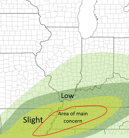 Current Snowfall Forecast 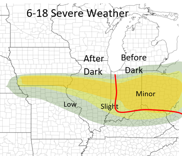 Precipitation map
0 Comments
Leave a Reply. |
AuthorWrite something about yourself. No need to be fancy, just an overview. Archives
January 2024
Categories |
 RSS Feed