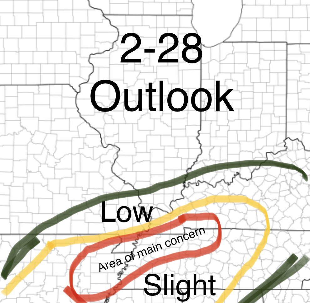
 Good morning guys! Not too much has changed from yesterday besides clarifying some of the main aspects to today's severe weather threat. Generally a small line of storms will start forming along a boundry that will be set from this mornings storms in the north end of the "Slight Risk" and move towards the Northeast, before a much stronger line comes in from Arkansas late evening and continues across the Mississippi River around 6-7pm. Some renegade cells as shown on the HRRR model picture below also show a small concern for more of a tornado threat but that is something we will have to watch. Generally the main area is that red circled area. Northern and western portions of that are during the Daylight hours but most of the Tennessee portion is 7-10pm for the storms. Main hazard will be damaging winds with these fast moving storms but a tornado or two can not be ruled out, and some small hail can be possible! All for now! Pictures of the HRRR are below! 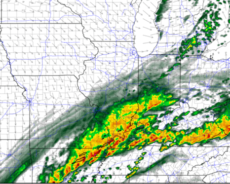 HRRR at 6pm 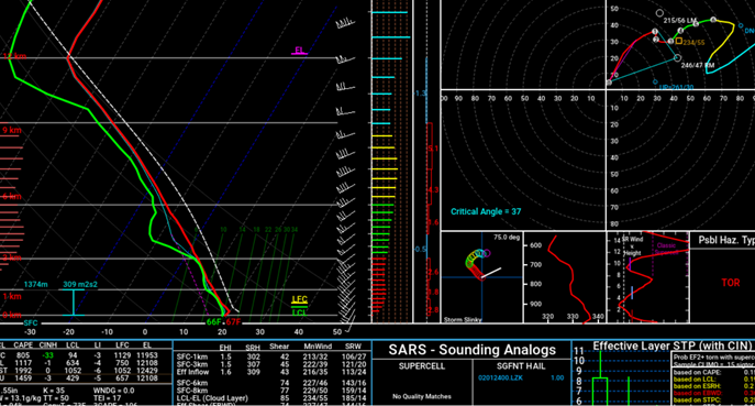 Hodograph over the bootheel of MO at around 6pm showing favorable conditions
0 Comments
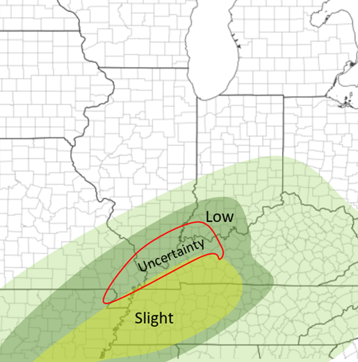 There appears to be a growing confidence that there will possibly be severe weather in the Mid-Mississippi River Valley tomorrow ahead of an advancing cold front, especially tomorrow afternoon. Although there are still some uncertainties. Currently the HRRR and RAP show a bit more backed system than the NAM does. The HRRR shows an "opening" of rain for Southern IL during the day Sunday, and also has the front a tad slower. Therefore having some cells developing early tomorrow afternoon across Southern IL and the rest of the region in the "Uncertainty" area. The Nam has a line beginning to form late morning from a boundary that was set during the very early morning storms in extreme Southern IL by late morning and ending by noon for that region. So, two completely different scenarios for Southern IL. Although for areas to the south of that in the "Slight" area, both models agree that a line of storms will develop and move through Sunday afternoon and into the evening hours more east. Due to more of a linear structure, this will largely be a damaging wind threat, although it appears that there will be a chance for couple tornadoes based on recent model trends showing some lower-level wind shear (S/SSW winds lower and SW/WSW winds in the mid-levels), as well as low chances of hail, although if the CAPE values (instability) continue to rise, that may be more possible (currently 800-1,200). Definitely something I will continue to watch and update! Stay tuned! 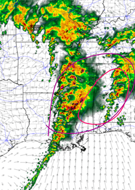 HRRR at 3pm Sunday 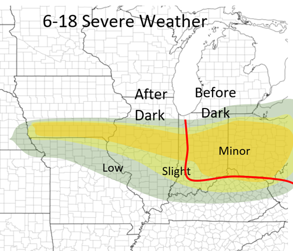 NAM at 2pm Sunday 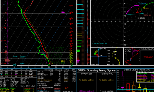 NAM Forecast Weather sounding for Western Kentucky at 2pm Sunday.
Temperatures and Dew Points are in the mid 60s ML Cape (area between the temperature (red line) and the air parcel (dotted line)) is 900+ (bottom left hand side) with a LI (Lifted index) value at -3 (anything less than 0 is unstable) Wind shear (hodograph in the top left): showing winds at the surface 10-15mph from the S/SSW, and winds in the mid-levels 25+ out of the SW. Interesting with the little area of less wind at about 800mb All of this shows severe weather is definitely possible along the cold front tomorrow afternoon! 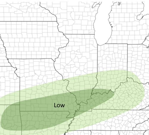 This event is mostly an overnight event. Severe weather is possible in southern IL 9pm-3am, although the chances are low. Still expect some thunderstorms during the night. Main threat would be damaging wind and hail, as well some possible flash flooding. A tornado is unlikely. If anything changes I will have an update!
|
AuthorWrite something about yourself. No need to be fancy, just an overview. Archives
June 2022
Categories |
 RSS Feed