|
Good afternoon everyone! This is the second main update for the winter storm that will be going through our region over the next 48-54 hours! There have been some minor changes since but generally not much has changed since the last post. Currently, it is raining over a majority of Illinois. Throughout the night tonight and tomorrow, this will change over to wintry mix, then to snow from northwest to southeast. Some of this is expected to freeze over so most areas will likely have a layer of ice tonight when it changes over to snow, so be careful! See the "transition to snow" map below: 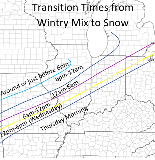 Depending on where you live, there will still be two main times of heavier precipitation during this event. Tuesday night-Wednesday evening and Thursday morning into the afternoon. The first patch is most significant and will bring the highest amounts of snow with it. Below are the snowfall totals for each time period. Daytime is 6am-6pm and nighttime is 6pm-6am 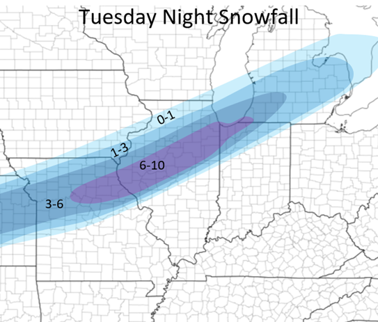 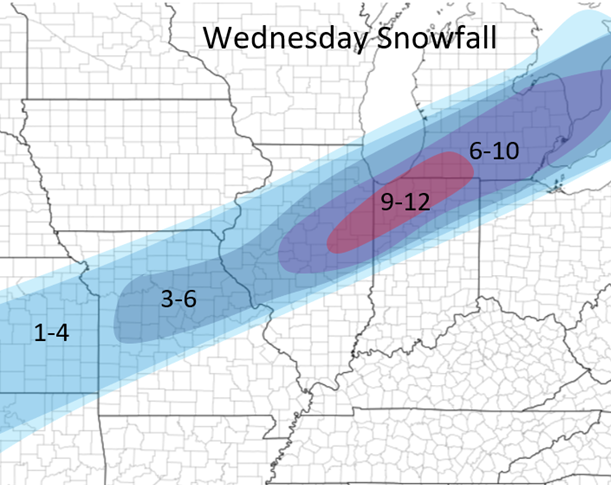 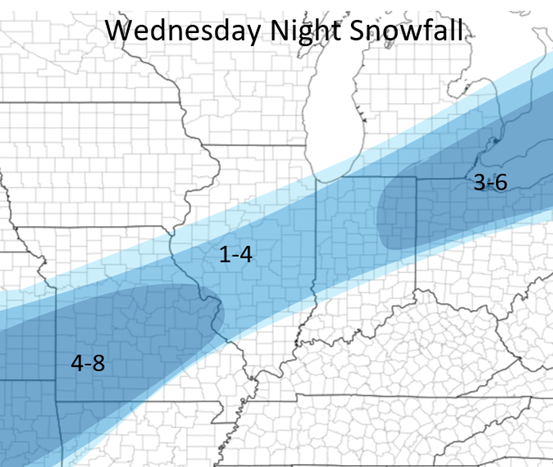 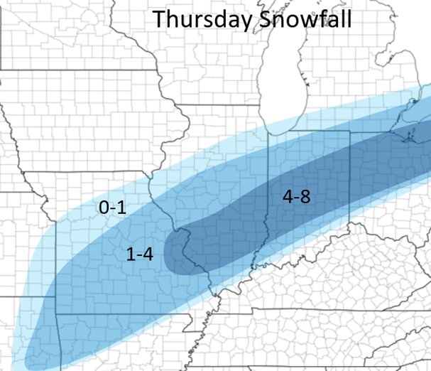 Below is currently my forecast with this event from now until Thursday Night. NOTICE that the Chicago region is more on this forecast than from the maps above. This is due to likely lake-effect enhancement Wednesday night and Thursday which the models are currently showing. Generally not including this, the Chicago area will receive 5-10 inches of snow but due to some more snow later on, the amounts are higher. This forecast can still change some although at the current time this is my best thinking due to the recent model trends. It is important to note that some areas within the "12-18" possibly could receive 18-20 in very localized areas and some could receive 22-25 in the 16-22 area. This is due to very small areas of heavy bands of snow but generally in these areas the general totals will be what is forecasted below: 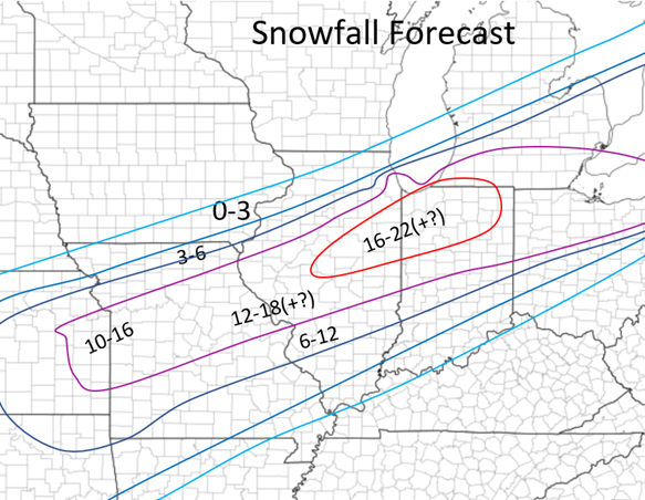 For more local forecasts for Central Illinois: Jacksonville: 14-18 inches Springfield: 14-18 inches Decatur: 14-18 inches Bloomington: 15-20 inches Champaign: 15-20 inches Peoria: 12-16 inches Quincy: 10-14 inches Below I also have a map with the ice risk. Above the purple line ins during the first half of the event and below the line is the latter half of the event. This is all for now, if there are any major changes I will provide updates! 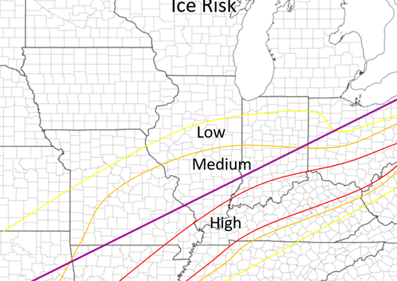
0 Comments
Leave a Reply. |
AuthorWrite something about yourself. No need to be fancy, just an overview. Archives
January 2024
Categories |
 RSS Feed